
 In 2025, the average Boston driver spent 83 hours stuck in traffic. That's more than two full work weeks of your life. Gone. Sitting still. The wasted time cost each driver about $1,529 in fuel and lost productivity.
Boston ranks as the 5th most congested city in the United States and the 12th most congested city in the world.
But here's the part nobody seems to know: Boston was never designed for cars. Not for many cars. Not for any cars. The streets you're stuck on right now were laid out roughly 400 years ago — by people walking. And once you understand that, everything about Boston traffic, and everything about how Boston is responding to it, starts to make a very different kind of sense.
The Cowpath Myth
There's an old story that Boston's streets were laid out by cows. The cows wandered, the paths formed, the streets followed. It's a fun story. It's also not really true.
The actual reason Boston's streets are the way they are comes down to three things: topography, geography, and the simple fact that the city was founded in 1630.
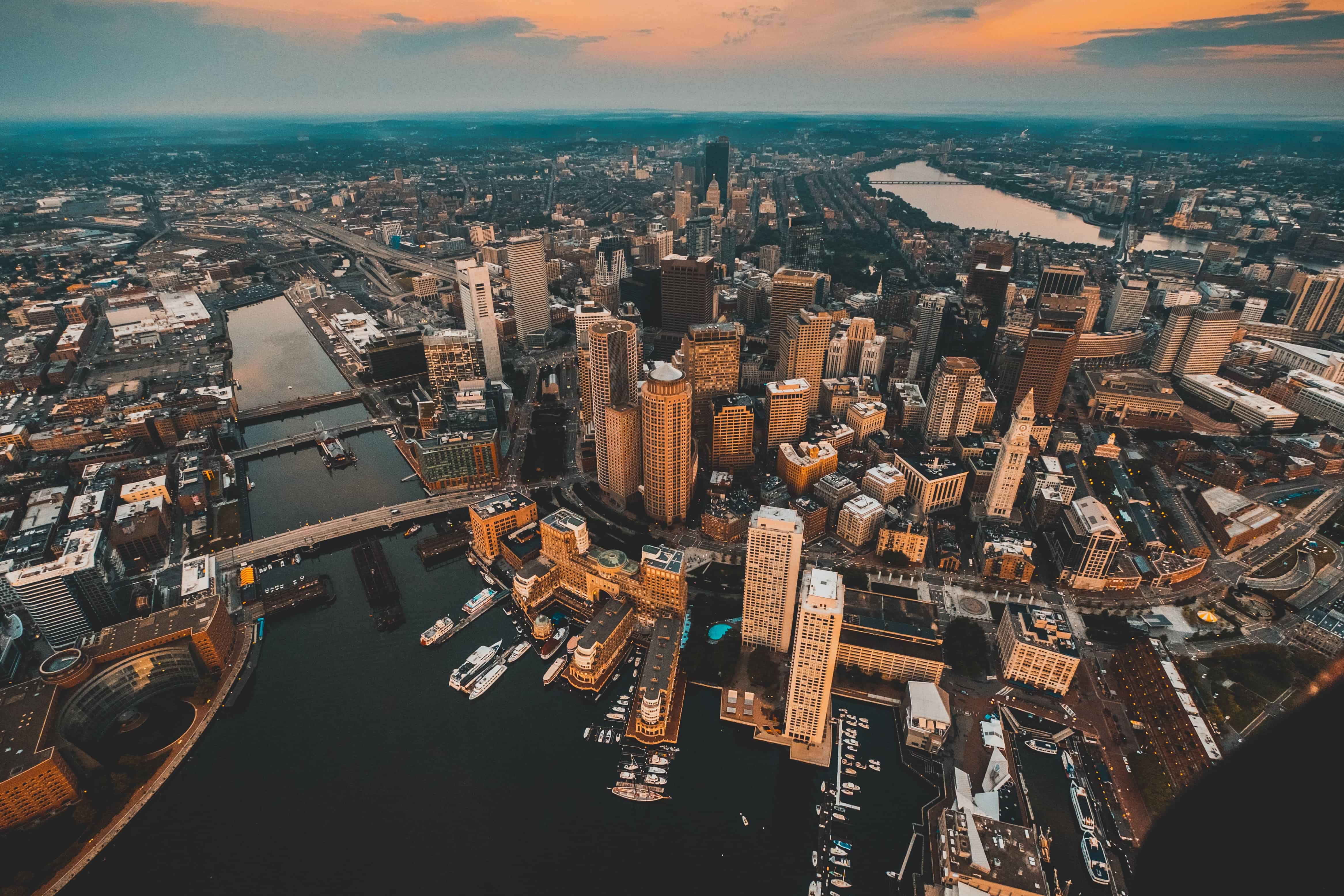
Boston was originally a peninsula — a narrow piece of land sticking into the harbor, surrounded by water on almost every side, with three significant hills, several streams, marshes, and tidal flats. The original settlers built streets that followed the contours of the land. Streets that climbed around hills. Streets that traced old creek beds. Streets that hugged the shoreline. Streets that were intentionally narrow, because narrow streets were easier to defend from attack. Streets where the second story of buildings overhung the first, so windows could be boarded up quickly in an emergency.
These streets were designed for foot traffic. Maybe a horse. Maybe a cart. They were never designed for sedans, delivery trucks, or 50,000 commuters per hour trying to push from the suburbs into downtown.
Over the next two centuries, Bostonians filled in the tidal flats. They leveled hills. Beacon Hill used to be much taller, before the top was carved off to fill the marshes that became the Back Bay. Each time the city expanded, new street patterns were laid on top of old ones. The Back Bay has a beautiful, ordered grid. But it doesn't align with the grid of the South End. Which doesn't align with the grid of downtown. Which barely has a grid at all.
A data scientist once mapped the orientation of streets in major American cities. In Chicago and Denver, streets line up almost perfectly north, south, east, and west. In Boston, the streets point in every direction at once. There is no single grid. There are many grids, layered on top of each other, mostly out of alignment, separated by older roads that follow no logic at all.
This is the canvas. This is what Boston had to work with when the automobile arrived.
The Highway That Broke the City
In 1959, Boston built a six-lane elevated highway right through the middle of downtown. They called it the Central Artery. It carried Interstate 93 traffic over the city, with on-ramps and off-ramps spilling cars onto streets that were never meant for them.
It was designed to handle 75,000 vehicles per day.
By the early 1990s, it was carrying roughly 200,000 — nearly three times its design capacity. The accident rate on the Central Artery was four times the national average. Traffic crawled for more than 10 hours every single day. Without intervention, engineers projected that by 2010, downtown Boston would have a traffic jam lasting up to 16 hours a day.
And the highway didn't just cause traffic. It physically cut the city in half. The elevated structure separated the North End and the waterfront from the rest of downtown. It displaced about 20,000 residents when it was built. Mayor Tom Menino once called it Boston's "other Green Monster" — painted green, just as ugly as it was inconvenient.
So Boston did something extraordinary. They decided to put the highway underground.
The Big Dig
The Central Artery and Tunnel Project — the Big Dig — was the most expensive highway construction project in the history of the United States. The original estimate was about $2.8 billion. With interest, the final cost was roughly $24 billion. Construction officially ran from 1991 to 2007. Sixteen years of digging, while the city kept functioning above it.
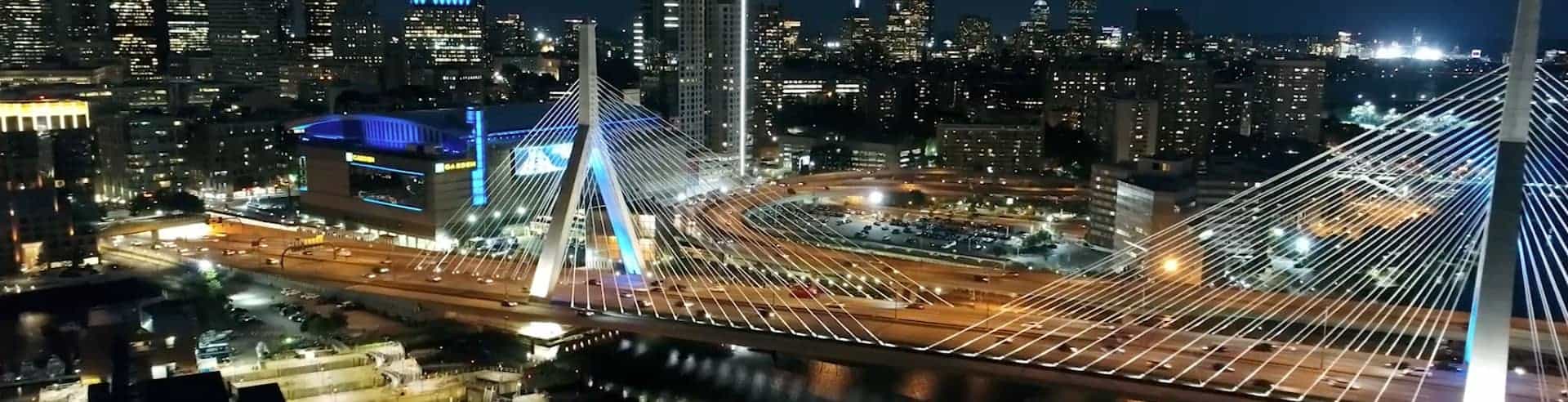
The scope was almost absurd. They moved an interstate underground without closing it. They built the Ted Williams Tunnel under Boston Harbor to connect the highway to Logan Airport. They constructed the Zakim Bunker Hill Bridge over the Charles River — the widest cable-stayed bridge ever built. They relocated 46 kilometers of utility lines. Thirty-one separate utility companies were involved. 3.8 million cubic yards of concrete poured. 16 million cubic yards of soil excavated.
Did it work?
Partially. Travel times on those specific stretches of highway dropped by 62%. Carbon monoxide levels in downtown Boston fell by 12%. The project freed up 27 acres of land where the elevated highway used to stand — land that became the Rose Fitzgerald Kennedy Greenway, a chain of parks, plazas, and gardens running through the heart of the city.
But the Big Dig did not solve Boston traffic. It moved it. Bottlenecks shifted from downtown to the suburbs. Commutes outside the city core actually got worse. And as we said at the top, in 2025, Boston still ranks among the most congested cities in the world. 83 hours per driver. $2.9 billion in lost productivity citywide.
So if a $24 billion tunnel project couldn't fix Boston traffic, what can?
This is where the story gets interesting.
What Boston Is Actually Good At
Boston's real innovation — the thing that may turn out to matter much more than the Big Dig — isn't about adding lanes. It's about not needing them.
Boston is consistently ranked among the most walkable cities in the United States. Walk Score gives Beacon Hill 99 out of 100. The North End: 99. Bay Village: 98. Chinatown: 98. In these neighborhoods, you genuinely do not need a car. Daily errands, restaurants, groceries, work, friends — all within walking distance.
About 11% of commuters in the Boston metro area use public transit. That's more than double the national average. Boston has the oldest subway system in America, opened in 1897. It's not perfect — the T has its issues, and locals will tell you about every single one of them — but it works, and it carries hundreds of thousands of people every day who would otherwise be in cars on those 83-hour roads.
And the city is leaning further into this. Boston has been steadily adding dedicated bus lanes, optimizing traffic signals, building protected bike infrastructure, and encouraging mixed-use development that puts homes near jobs near transit. Between 2023 and 2024, Boston achieved the largest single-year reduction in traffic congestion of any of the 25 most congested American cities — a 10% drop in hours lost to traffic.
That didn't happen because they built more highways. It happened because the city is making it easier to not drive at all.
The Quiet Revolution
Boston is becoming a model for what comes after the car-centric city. Not by accident. By necessity. The streets cannot be widened. The geography won't allow it. So Boston is doing something almost no other American city is willing to do — it's choosing to be a walking and transit city in the 21st century, the same way it was a walking city in the 17th.
When somebody complains that Boston wasn't built for this traffic, they're technically correct. Boston wasn't built for this traffic. The streets are too narrow. The grid is too tangled. The highway is too small. The peninsula is too crowded.
But here's the deeper truth: Boston wasn't built for traffic because it was never supposed to need it. The city was a walking city for 300 years before the automobile arrived. The automobile was the thing that didn't fit. Not the streets.
And maybe that's the part of the story worth paying attention to. Because the rest of the country is slowly figuring out what Boston has known for centuries. Cars are a tool. They are not a city. And the future of urban living, almost certainly, looks a lot more like Beacon Hill than like a Houston freeway.
Boston is just getting there first. Again.